![Map of the S. Croce Bigolina area with the division in lots � CLICK FOR THE PLANIMETRY OF THE AREA [.pdf 366 kb]](../img/map1_scroce.gif) S. Croce Bigolina Production Area
S. Croce Bigolina Production Area
All lots have already been granted.
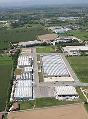
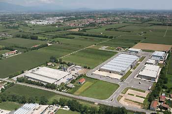
The area at S. Croce Bigolina – located north-east of the territory of Cittadella and covering 152,076 sq. m. – has been expressly designed for the settlement of craft and manufacturing enterprises, which are peculiar to the surrounding economic fabric. The area has been tested on 22/09/2008.
The area has been divided in 11 lots having a 4,000/6,000 sq. m. average size.
The lots will be equipped with all the necessary underservices and connected to the various mains (see below).
The total area for gardens and parks covers 7,493 sq. m total surface.
The road system has been designed so that it will not interfere with that of the town. The main road has a 21 m cross section with two lanes for each direction (4.5 m each one), including pavements, bicycle paths and parking or emergency lanes on both sides.
Besides the parking places on the sides of the roads, there are seven more car park areas covering a 11,014 sq. m. total surface.
At each factory
- Electricity mains
- Drainage mains
- Water mains
- Telephone lines
- Fibre optic
- Gas mains
The enterprises which have been granted the lots carry out their activities especially in the field of precision mechanics, carpentry, manufacturing production, textiles.